Lesson 51 - Friday September 3rd
Solo for 400 miles
Today was a very long day. Craig had told me I would probably do a long solo flight today, from here (SMO) to Paso Robles (PRB) and back via Bakersfield (BFL). Again I get lucky with the weather, and it's clear and not too windy at all those places. I'd spent most of the morning preparing, getting the flight plan ready. I've got 8148H booked for five hours from 12 noon.
So, I arrive, Craig looks over my flight plan, deems it satisfactory. He then has me file a flight plan, which is where you inform Flight Services (Hawthorne FSS) of where you are going, so they can send out a search party if you fail to arrive. I file this by phone, and I'm supposed to open it by radio when in the air, and then close it at Paso Robles by phone.
All seems well, I set off in 8148H. However, when I get it to the run-up area, it starts acting up, the engine running very rough on the left mag. I try to clear it, but with no success, and in fact it gets stranger, as the engine does not get an RPM drop as I lean it, and in fact keeps running with mixture lever seemingly at full lean, not right at all. So I take the plane back.
I park the plane and call the Justice office. I explain the problem to Joe, and he comes down and gives me the keys 8074T, a very similar plane to 8148H. While I'm pre-flighting 74T, Joe investigates 48H, and discovers something wrong with the mixture lever, and takes it off to maintenance.
74T gives me no problems at this point, and I take off in the normal manner, with a right turn at the shoreline.
I turn to my approximate heading of 300, and tune the VOR to 117.5, the "Fellows" VOR, halfway from here to PRB.
I then start the radio work, I call Hawthorne FSS on 122.5, and ask them to open my flight plan with the plane N-Number changed. This goes relativly smoothly. I then call Socal on 134.2, and ask for flight following. They direct me to call Pt. Mugu approach on 124.7, so I do, and establish flight following to PRB.
All this radio work takes a little time, and I'm not paying that close attention to my instruments as I should. I'd been cruising along at 4500 to get out from under the Class-B, and then I'd kind of angles West a bit, and ended up over Camarillo airport, when I should really have passed about 12 miles east of it. I correct my course and turn north, heading toward the Fellows VOR.
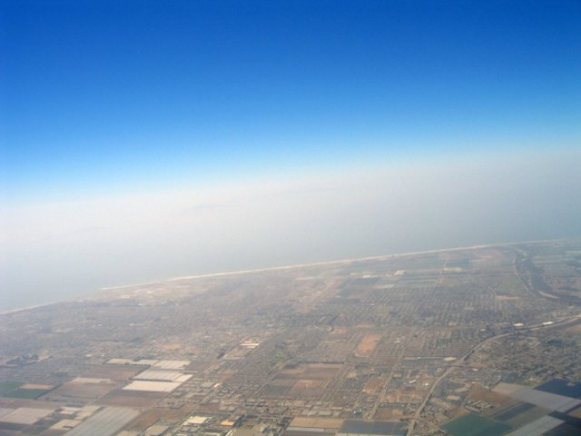
That's the view kind of south west, looking towards (I think)
Oxnard or Ventura.
I climb up to 9500 feet, to get over the mountains, which peak at 7500 here. As I approach the mountains the turbulance starts up. The weather report had called for "occasional to moderate turbulance", which is exactly what I got. Some mild jostling for most of the trip.
Around this time I take a bunch more pictures, as my Navigation workload is pretty low.
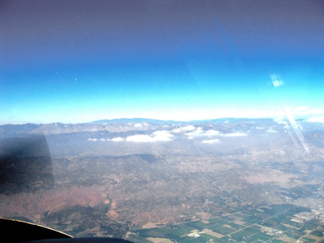
Here I'm around Ojai, looking NE.
A bit further north, looking West.
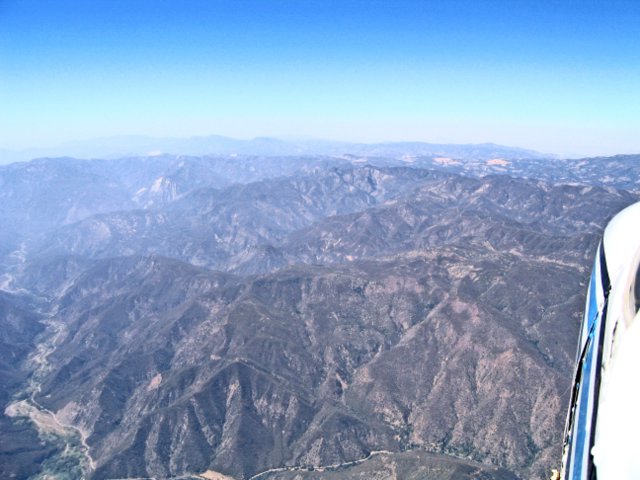
The view North.

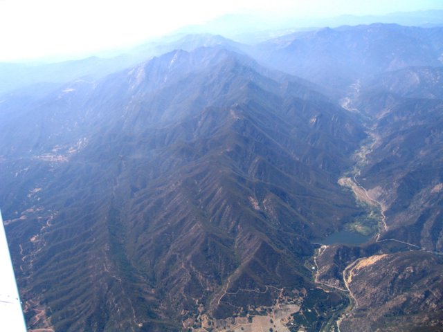
Over the mountains, South of Ventucopa, looking East.
I pass Fellows, and head for PRB, which has a VOR on the field. I begin my descent a bit early, and end up about 12 miles from the airport at 2500 feet, which probably did not help be find it.
I do have a bit of trouble finding it, and I actually get out my GPS, cheating a little, but it gives a very definite indication. I probably could have found it by looking at the roads, and it turns out I was not too far off, just pointing a bit in the wrong direction.
I tune to the CTAF (Common Trafffic Advisory Frequency) of 123.0, and listen for a minute, I head people announcing traffic for runway 31. I then announce where I am, and say I'll make left traffic for runway 31.
As I approach there are more announcements about left traffic 31. I approach the downwind at 45 degrees, but as I enter it, a Cessna also enters it from the Crosswind. Neither of us is at the correct altitude, I'm at 1500 and she's at 2000, when we should be at 1836. She'd announce she was climbing to 2000 feet, and I think I'd misheard her and assumed she was departing, climbing through 2000, and so would be well above me, but she was actually going around the pattern.
So, I just make a right 360 to give her room. She lands, I'm back on downwind, and I just land in the usual manner. Not the best landing, but better than my RAL landing on Monday.
I taxi to the end of the runway, and exit it, crossing runway 1, and pootle on down the taxiway until I find the transient parking, next to the fuel place. I tie up the plane (they have tiedowns of chains on cables. I go into the fuel place and tell them I need fuel. The fuel truck guy gets up and goes out to fill me up. Pretty straightforward.
I then close my flight plan. They have a phone there preset to dial the Hawthorne FSS 800 number (1-800-WX-BRIEF).
Then I relax for a while, and have a snack. I'm getting a bit tired, but that was the longest leg. It took me about 1 hour and 20 minutes in the air.
The fuel guy takes a while, but he final comes back and I pay (22.7 gallons, for $67.87), and by this time it's about 4PM, so I call Holly to let her know I'll be a little late.
Back in the plane, I get everything set, and try to start it. The plane does not start, it just turns over several times, but does not fire. I try again, and again, and again, but still nothing. Gulp! I'm stranded in Paso Robles!
I think maybe I've flooded it, so I'll just look in the POH (Pilots Operating Handbook) to see what the procedure is. I eventually find it, and try that. I then see there's a procedure for starting the engine hot, and so I try that. After about ten attempts, the engine finally roars into life, and I breath a great sigh of relief.
The wind is actually pretty variable, and very light. There is nobody around, so I make my announcements, and take off from runway 1, and head west.
I contact Oakland Center on the same frequency I used last, and get flight following to Bakersfield.
I'm starting to feel kind of tired by now. This is probably the worst leg of the trip in terms of discomfort and boredom. Still the scenery is not without interest.:
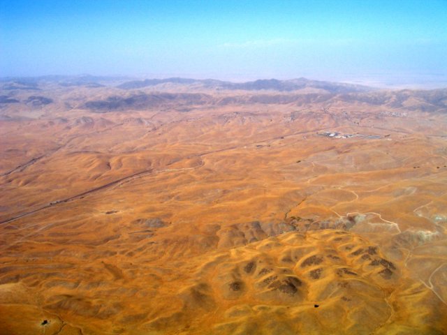
This is the view north, just past Cholame. I'm a bit
north of my intended route.
In the above picture you can see various things that you can spot on the map. The two roads coming together on the right are quite distinct. The small complex towards the upper right of the land is a water treatment plant, also marked on the map. The mountains behind don't look particularly distinctive, but they actually stand out in a wider picture, as off to the right is the flat expanse of the California central valley.
Eventually I arrive at Bakersfield, and am directed to make left fraffic for runway 30L. Now Bakersfield has two runways, 30L and 30R. 30L is 3700 feet long, and 30R is 10857, but has a displaced threshold, so it actually starts about where 30L ends.
I land on 30L, and then ask to depart 30R, which means hardly any taxiing needed. There seems to be practically no traffic at Bakersfield, and I only hear one other plane the whole time I'm on the ground. I get cleared fairly quickly, and take off with the right downwind departure.
As I'm on the downwind, I take this shot:
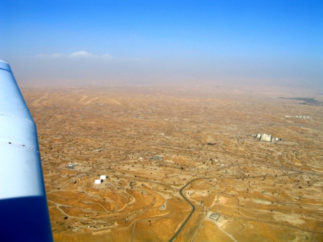
Oil wells as far as the eye can see. This is in a place called Oildale, just north of Bakersfield.
After a few minutes of radio silence, and when I'm about clear of the Class-D, I request a frequency change, and re-contact Bakersfield Approach (my last frequency before switching to tower), and request flight following to Santa Monica.
I get a squawk, and then he tells me that LA is too busy to take VRF flight following, so they'll have to do "something" after I get past Gorman. I get a little nervous, thinking I might be left alone, but then I figure all I need to do is skirt the Van Nuys airspace, which is only a very minor deviation from my intended course (a lot more minor than my actual deviations so far).
And as it happens I don't have to worry. I actually get handed off all the way to SMO, with just the instructions "Stay west of the Van Nuys Class-D".
After I come over the mountains at 9500 feet, I descend down to 3500 feet, getting there at around Simi Valley, then I continue south, occasionally looking at my GPS to make sure I'm clear of the Class-C.
I eventually get handed off to SMO tower, and hear the familiar "Right traffic, report abeam", and cruise in for a very normal landing, finally getting out of the plane at about 6:15. Tired, but feeling very happy.
